LANDFORMS
This picture shows some landforms.
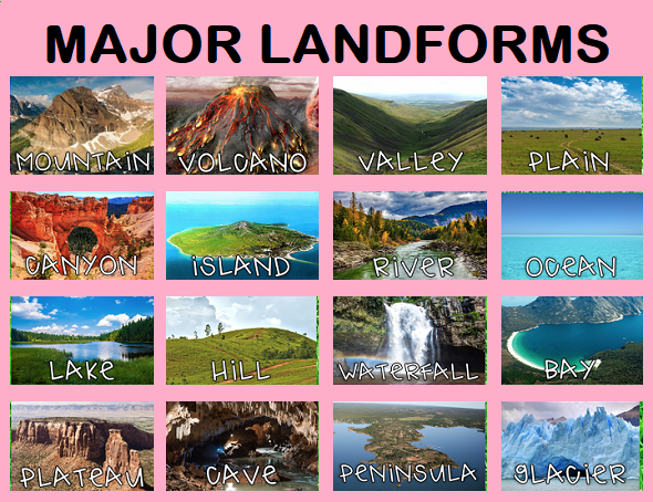
What are Landforms?
A landform is a natural feature of the Earth's Surface. The land has different shapes and forms.
Let's Review the following - pond, reef, peninsula, bay and isthmus
A landform is a natural feature of the Earth's Surface. The land has different shapes and forms.
Let's Review the following - pond, reef, peninsula, bay and isthmus
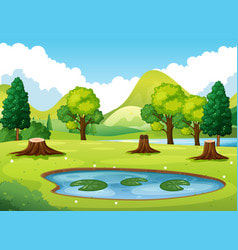
A Pond is a small area of still, fresh water surrounded by land but smaller than a lake but larger than a pool.
A pond can be formed -
1. Naturally- when water fills depressions in the earth or a river over flows forming one
2. Artificially - man made. Land is dug up to make a large depression to be filled by rain.
Ponds are used for agricultural, fishing, recreational and even industrial purposes.
E.g. Usine Ste. Madeline Ponds were used in the manufacturing of Sugar, LA Vega ponds are used for recreation
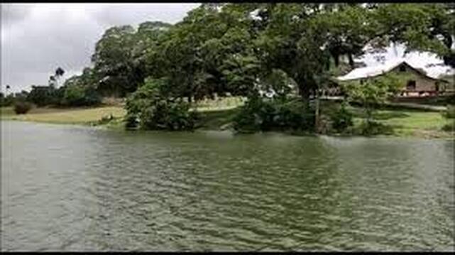
Usine Ste Madeline Pond
|
|
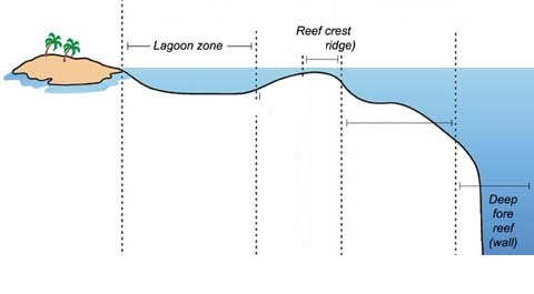
A Reef
A reef is a bar of rock, sand or coral just below the surface of the sea. The video below shows our most popular reef in Tobago- Buccoo Reef
|
|
|
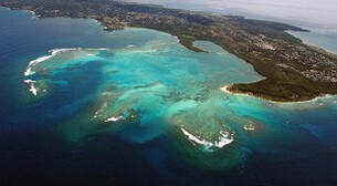
A Peninsula
A peninsula is a piece of land that extends into a body of water that is almost surrounded by water on 3 sides. The picture below shows the south west peninsula of Trinidad
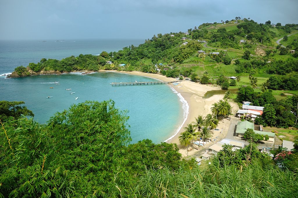
A Bay
A bay is a body of water that is partly surrounded by land on 3 sides.
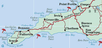
Examples of Bays in Trinidad -Maracas Bay, Las Cuevas Bay, Mayaro Bay
Examples of Bays on Tobago - Canoe Bay, Englishmans Bay, Parlatuvier Bay
Examples of Bays in Trinidad -Maracas Bay, Las Cuevas Bay, Mayaro Bay
Examples of Bays on Tobago - Canoe Bay, Englishmans Bay, Parlatuvier Bay
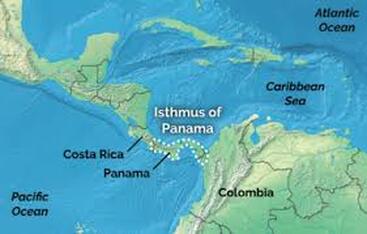
An Isthmus
An isthmus is a narrow strip of land with sea on either side, forming a link between two larger pieces of land.
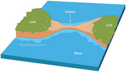
Most Well Known Isthmus is the Isthmus of Panama
Learn the definitions of each landform
There is a Unique Landform found in Trinidad and Tobago on the island of Chacachacare - a Salt Pond
On the south-western end of the island of Chacachacare lies a magnificent triangular salt pond that is approximately 13,578 square meters (145,152 sq ft) in area.
Created by a sand and shingle bar that trapped sea water from a bay, the salt pond is one of the best attractions of the island.
Due to the high salinity levels (three to four times the salinity of the sea), the salt pond is warm, relaxing and one can float easily float without fear of sinking. Some claim that the hyper-salinity, much like the Dead Sea near Jordan has therapeutic properties. It is said that the pond was a source of salt for Amerindians, the islands’ first inhabitants, who travel to Chacachacare to collect blocks of salt formed from the evaporation of the salt water.
The pond is bordered by vegetation such as mangrove, manchineel and sea-island cotton, and is best accessed from its eastern side, where the shingle bank of about 30 ft wide separates the pond from the Gulf of Paria.
